The UK Centre for Observation and Modelling of Earthquakes, Volcanoes and Tectonics (COMET) invites you to the next instalment of our COMET+ webinar series, viewable from the home office.
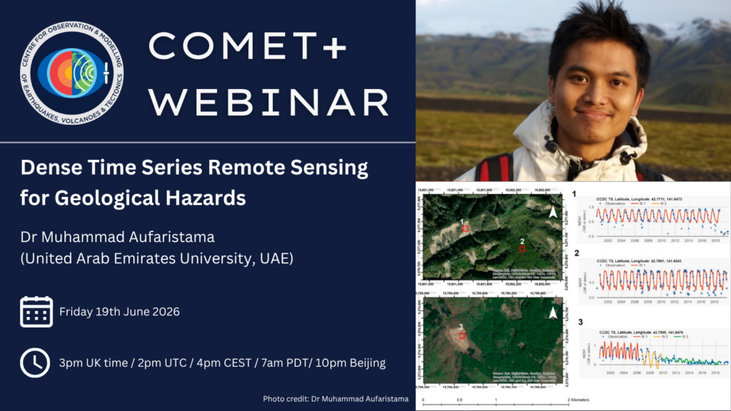
Speaker: Dr Muhammad Aufaristama, United Arab Emirates University, UAE
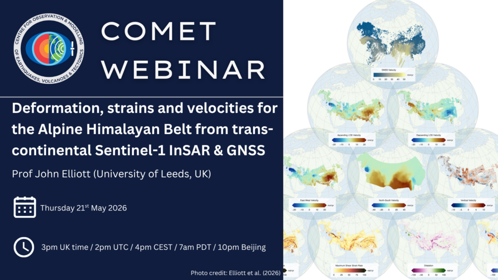
Title of the talk: Dense Time Series Remote Sensing for Geological Hazards
Date: Friday 19th June 2026
Time: 3pm UK time (2pm UTC / 4pm CEST / 7am PDT / 10pm Beijing)
(After registering, you will receive a confirmation email containing information on how to join the webinar)
Abstract: Dense satellite time series are changing how geological hazards can be observed, shifting the focus from isolated before–after image comparisons to continuous monitoring of disturbance, timing, and recovery. This talk focuses on landslides as a model geohazard and shows how long optical Earth observation archives can be used to detect where failures occur, when they happen, and how affected terrain recovers afterwards. Building on recent work with Continuous Change Detection and Classification (CCDC) in Google Earth Engine and the LandTrendr temporal segmentation framework, I use Landsat-derived NDVI trajectories, together with topographic constraints where appropriate, to identify disturbance–recovery signatures associated with landslide activity. Examples from globally distributed test sites and regional-scale applications in Indonesia demonstrate that dense time series remote sensing can support scalable inventory generation, historical reconstruction, and semi-automated monitoring across diverse environments. The results also highlight key limitations: performance remains sensitive to cloud cover, rapid revegetation, medium-resolution pixel size, and the detectability of small failures. Overall, the work shows that the main value of dense time series lies not only in mapping surface disturbance, but in capturing its temporal evolution, with potential relevance beyond landslides wherever hazards produce measurable surface change.