
On 6 February, a 7.8-magnitude earthquake struck the East Anatolian Fault affecting large areas of Southern Türkiye and Northern Syria. This was followed by a 7.5-magnitude event approximately 9 hours later, around 60 miles to the north. To date more than 37,000 people are confirmed to have died, large numbers of people are affected across the region and the damage to buildings and infrastructure is significant.
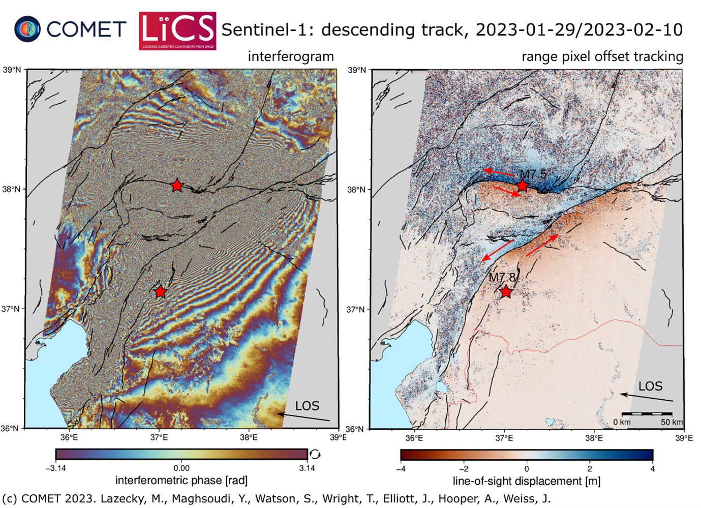
Images from ESA’s Sentinel-1A satellite captured on 9/10 February clearly showed the physical effects of the earthquake on the ground, including deformation of up to 6 metres along a 300km section of the fault, and the second event causing a second ~125km rupture. Many population centres sit close to these zones, explaining the significant human impact of the event.
By combining Sentinel-1A imagery from before and after the earthquake, COMET scientists have been able to measure surface deformation that is clearly visible in InSAR and pixel offset tracking data sets shown below:
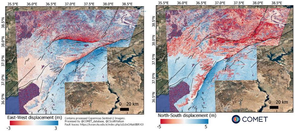
In addition to the results from the satellite radar data, we have also used the pre- and post-event optical images from Sentinel-2 to estimate ground movement in the earthquakes also using pixel tracking:
The processing outputs from Sentinel-1A data are available for download at our LiCSAR system event page. The results from Sentinel-2 are available here.
The images above contain modified Copernicus Sentinel-1 and Sentinel-2 data analysed by the Centre for the Observation and Modelling of Earthquakes, Volcanoes and Tectonics (COMET). Data processing uses JASMIN, the UK’s collaborative data analysis environment (http://jasmin.ac.uk).
For more information on why and how COMET responds to earthquake events read this article by COMET Director – Professor Tim Wright.
COMET – 14 February 2023
