Tag Archives: volcanic ash

Airborne volcanic ash detection using infrared spectral imaging

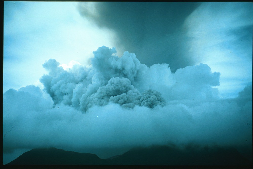
A new paper in Scientific Reports, co-authored by COMET’s Tamsin Mather, has demonstrated for the first time that airborne remote detection of volcanic ash is possible.

Airborne volcanic ash is a known hazard to aviation, but there are no current means to detect ash in-flight as the particles are too fine for on-board radar detection and, even in good visibility, ash clouds are difficult or impossible to detect by eye.

The economic cost and societal impact of the Icelandic eruption of Eyjafjallajökull generated renewed interest in finding ways to identify airborne volcanic ash in order to keep airspace open and avoid aircraft groundings.

The research, led by COMET Board Member Fred Prata, involved designing and building a bi-spectral, fast-sampling, uncooled infrared camera device (AVOID) to examine its ability to detect volcanic ash more than 50 km ahead of aircraft.

Experiments conducted over the Atlantic Ocean, off the coast of France involved an artificial ash cloud being created from a second aircraft, using ash from the Eyjafjallajökull eruption itself.

The measurements made by AVOID,  along with additional in situ sampling, confirmed the ability of the device to detect and quantify ash in an artificial ash cloud.  This is the first example of airborne remote detection of volcanic ash from a long-range flight test aircraft.

The full reference is Prata, A. J. et al. Artificial cloud test confirms volcanic ash detection using infrared spectral imaging. Sci. Rep. 6; doi: 10.1038/srep25620 (2016).

Tracking the Etna eruption

On the evening of December 2 2015, Sicily’s Mount Etna began to erupt for the first time in over two years, reaching a brief but violent climax in the early hours of December 3 which included lava fountains as well as a column of gas and ash several kilometres high. The event was among the most violent seen at Etna over the last twenty years.

Ash cloud from Mount Etna’s Voragine crater lights up the sky. Credit: Marco Restivo/Demotix/Corbis

Luckily, good weather meant that the eruption could be monitored with visual and thermal cameras from the Istituto Nazionale di Geofisica e Vulcanologia (INGV) Etna Observatory.  According to INGV reports, activity peaked between 02:20 and 03:10 GMT when a continuous lava fountain reached heights well above 1km; with some jets of volcanic material reaching 3km into the sky.  Although the eruption had more or less ceased by dawn, the volcanic cloud had blown northeast, causing ash to be deposited on the nearby towns of Taormina, Milazzo, Messina and Reggio Calabria.

The eruption has so far continued, repeating the behaviour seen earlier with tall lava fountains and eruption columns many kilometers high.  Updates can be found on the INGV webpage.

COMET scientists at the University of Oxford have been tracking the volcanic plume’s progress using data from the Infrared Atmospheric Sounding Instruments (IASI) on board ESA’s MetOp-A and MetOp-B satellite platforms.  These instruments can detect the presence of volcanic SO2 in the atmosphere, using methods developed by the University’s Earth Observation Data Group.

The results, which can be found on the IASI NRT web page, showed that by Friday 4 December the plume had reached an area between Crete and Iraq, containing 0.06 Tg (1012g) SO2.

Estimate of SO2 amount from IASI-A overpass on the morning of 3 and 4 December 2015, assuming the SO2 between 9 and 10 km altitude

By the morning of 7 December, the plume had travelled from Sicily to Asia, reaching as far as Japan and the Pacific Ocean.

Screenshot from IASI NRT webpage 7 December 2015

Dr Elisa Carboni, a COMET researcher based at the University of Oxford, said: “This is a great example of how we can track volcanic plume using the near real time IASI service. ”

You can follow the volcanic plume on the IASI NRT web page.


Icelandic volcano’s toxic gas is treble that of Europe’s industry

A huge volcanic eruption in Iceland emitted on average three times as much of a toxic gas as all European industry combined, a new study has revealed.

Bárðarbunga eruption. Credit: John Stevenson.

Discharge of lava from the eruption at Bárðarbunga volcano, starting in August 2014, released a huge mass – up to 120,000 tonnes per day – of sulphur dioxide gas.  You can watch a video of the eruption here.

These emissions can cause acid rain and respiratory problems.

Researchers hope that their study, published by the Journal of Geophysical Research, will aid understanding of how such eruptions can affect air quality in the UK.

Dr Anja Schmidt, a COMET Associate from the School of Earth and Environment at the University of Leeds, who led the study, said: “The eruption discharged lava at a rate of more than 200 cubic metres per second, which is equivalent to filling five Olympic-sized swimming pools in a minute. Six months later, when the eruption ended, it had produced enough lava to cover an area the size of Manhattan.

“In the study, we were concerned with the quantity of sulphur dioxide emissions, with numbers that are equally astonishing: in the beginning, the eruption emitted about eight times more sulphur dioxide per day than is emitted from all man-made sources in Europe per day.”

The eruption last year was the biggest in Iceland for more than 200 years. It released a river of lava across northern Iceland, and lasted for six months.

The team, which also included COMET members Tamsin Mather, Elisa Carboni and Don Grainger from the University of Oxford, used data from satellite sensors to map sulphur dioxide pollution from the eruption. These were reproduced by computer simulations of the spreading gas cloud.

As well as being given off by volcanoes, sulphur dioxide is also produced by burning fossil fuels and industrial processes such as smelting. Man-made sulphur dioxide production has been falling since 1990, and was recorded at 12,000 tonnes per day in 2010.

Further information

The research was funded by the Natural Environment Research Council (NERC) and the Royal Society of Edinburgh.

The study, ‘Satellite detection, long-range transport and air quality impacts of volcanic sulfur dioxide from the 2014-2015 flood lava eruption at Bárðarbunga (Iceland)’, is published by the Journal of Geophysical Research.


Measuring the refractive index of volcanic ash – new paper in Journal of Geophysical Research

COMET scientists’ Tamsin Mather, David Pyle and Roy Grainger have a new paper in the Journal of Geophysical Research on the detection and quantification of volcanic ash.

Credit:BGS

This is extremely important to the aviation industry, civil defence organisations and those in peril from volcanic ash fall, using remote sensing techniques to monitor volcanic clouds and return information on their properties.

The paper presents the complex refractive index of volcanic ash at 450.0 nm, 546.7 nm and 650.0 nm from eruptions of Aso (Japan), Grímsvötn (Iceland), Chaitén (Chile), Etna (Italy), Eyjafjallajökull (Iceland), Tongariro (New Zealand), Askja (Iceland), Nisyros (Greece), Okmok (Alaska), Augustine (Alaska) and Spurr (Alaska).

You can find the full paper, Measurements of the complex refractive index of volcanic ash at 450, 546.7 and 650 nm in the Journal of Geophysical Research, doi: 10.1002/2015JD023521.   

COMET scientists analyse Calbuco eruption

On 22nd April Calbuco volcano, Chile, erupted for the first time since 1972 with very little warning. Plumes of volcanic ash reached heights of 16 km on the 22nd and up to 17 km in a second, longer eruption that began in the early hours of 23rd April.

Several thousand people were evacuated from villages closest to Calbuco , and ash fell over an area extending from the west coast of Chile to the east coast of Argentina, and grounded air traffic in Chile, Uruguay and Argentina.

COMET scientists have been using satellite data to analyse the event, in terms of both the emissions and changes to the shape of the volcano itself.  You can read more about the event here.

Figure 4. Data, spherical source elastic half space model and residuals for recent deformation at Calbuco [Bagnardi].
Data, spherical source elastic half space model and residuals for recent deformation at Calbuco [Bagnardi].